If you have booked a vacation rental in South Lake Tahoe, you likely are looking up the variety of activities to do within close proximity. From beaches to hitting the trails, there is truly an endless amount of outdoor adventure available. If you are looking for a family Continue Reading
Fall Activities: Watch The Colors Change
While Lake Tahoe is mostly known for shades of blue, fall time is a local favorite for a few reasons. This is usually considered the "locals" shoulder season. Which means the town is quieter, the traffic has slowed and it feels like the locals get the town to themselves for Continue Reading
What To Do in Lake Tahoe This Winter
If you are planning a Lake Tahoe Getaway this Winter, there are no shortage of activities to choose from. In fact, every year Lake Tahoe gets 3 million visitors specifically looking to enjoy the recreation it offers. Whether you are traveling with kiddos or coming to the Continue Reading
The 27th Annual Celebrity Golf Tournament
One of the biggest summer weekends for vacation rentals in South Lake Tahoe (aside from 4th of July of course) is The Celebrity Golf Tournament. Taking place at Edgewood Golf Course, this 54-hole event includes a purse of $600,000 with a $125,000 for the winner. This high Continue Reading
Reason’s Why You Should Book A Midweek Stay
Lake Tahoe is a world class destination that draws 3 million visitors every single year. If you are one of those 3 million, this blog is for you. Booking travel typically takes some planning and research. Where to stay, how long to stay, when to get the best deal and when to Continue Reading
Lake Tahoe Weekend Update for March 9-14 2016
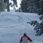
Lake Tahoe Fresh Snow Weekend Update 3/11-3/13/16 We have cabins open this weekend and lots of fresh snow to play in. Heavenly Mountain Resort reporting 21" of new snow in the last 72 hours Sierra At Tahoe reporting 42" of new snow since Continue Reading
Miracle March Possibilities of Great Snow in South Lake Tahoe
The forecast is looking hopeful for more snow to hit the high sierras. Check out Miracle March 2016 there are lots of different models pointing towards the possibility of great skiing/riding and playing ahead. Hopefully this will pull us out of the drought and fill Lake Continue Reading
Bijou Bike Park, South Lake Tahoe
When you are planning your next trip to Tahoe, make sure you pack your bike and helmet because the City of South Lake Tahoe recently opened up a new bike park which is drawing a lot attention. The Bijou Bike Park is set on a 5 acre plot next to the Bijou Skate park, and Continue Reading
SKI SEASON IS RIGHT AROUND THE CORNER
With each passing day, ski season is getting closer and closer. Not only is this the most beautiful time of year, it's the time where Tahoe is at its best. If you haven't already, you need to book your ski-cation as soon as possible to be able to make the most of all that Continue Reading
SnowGlobe 2015

SnowGlobe is Tahoe's biggest concert venue of the year. If you haven't already scheduled your trip to the lovely South Lake Tahoe, then you need to start planning now. Come see how beautiful Tahoe is during the most amazing time of the year. And don't forget to schedule your Continue Reading
- « Previous Page
- 1
- 2
- 3
- 4
- …
- 9
- Next Page »